|
|
|
| HOME PAGE | MAPS & GPS | RIDE VIDEO | ORV EVENTS | ORV SPONSORS |
|
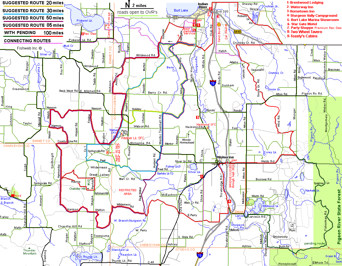
FILES FOR GPS UNITS
------------------------------------------
------------------------------------------ |
|
|
|
|
| HOME PAGE | MAPS & GPS | RIDE VIDEO | ORV EVENTS | ORV SPONSORS |
|
FILES FOR GPS UNITS
------------------------------------------
------------------------------------------ |
|